The cutting
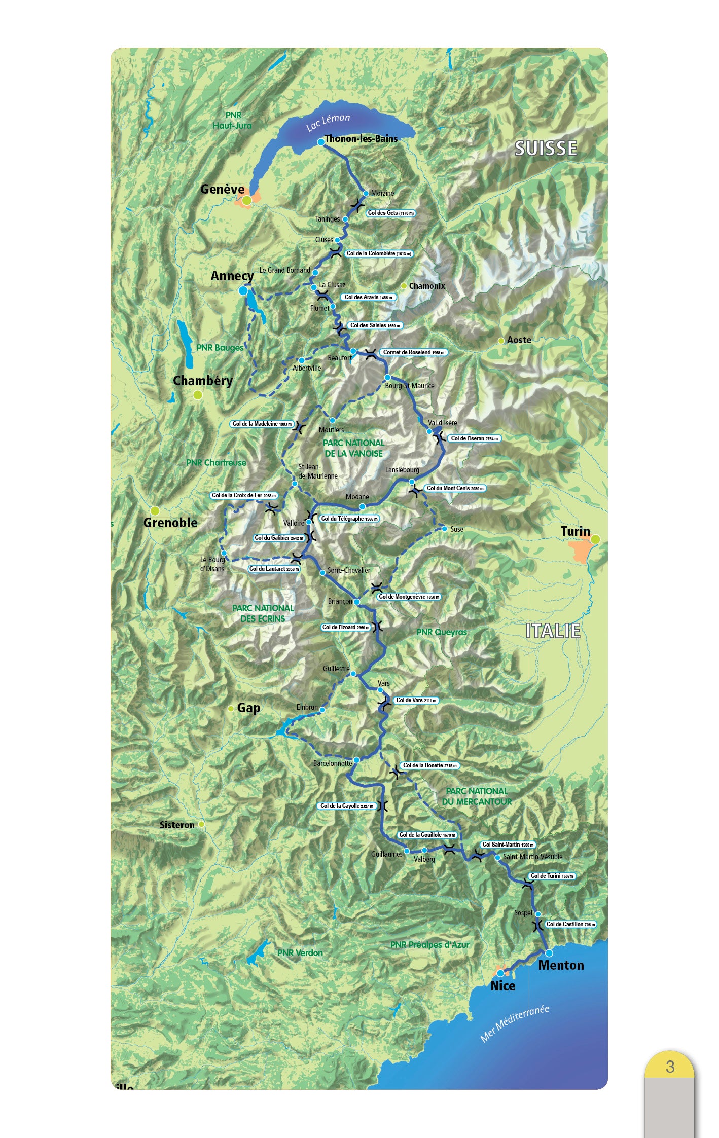
The breakdown of the stages proposed in this book leaves you free to choose to make this trip at your own pace. Depending on your level, or the time you have, you will complete one or more stages per day. It's up to you to determine what suits you best with the information in this topo.
Count on average 8 days to take full advantage of this mythical route (about 85 km/day).
Variants
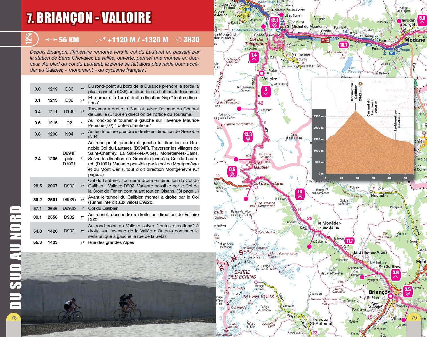
Six in number, the variants allow you to set off to discover a territory or attack a renowned pass. They also offer alternatives when not all passes are open, especially at the start of the season. Some 800 additional kilometers of roads to cover…!
- Pays : France
- Région(s) : Auvergne-Rhône-Alpes
- 12 étapes décrites
- Format pratique 12 x 19 cm et léger 400 g
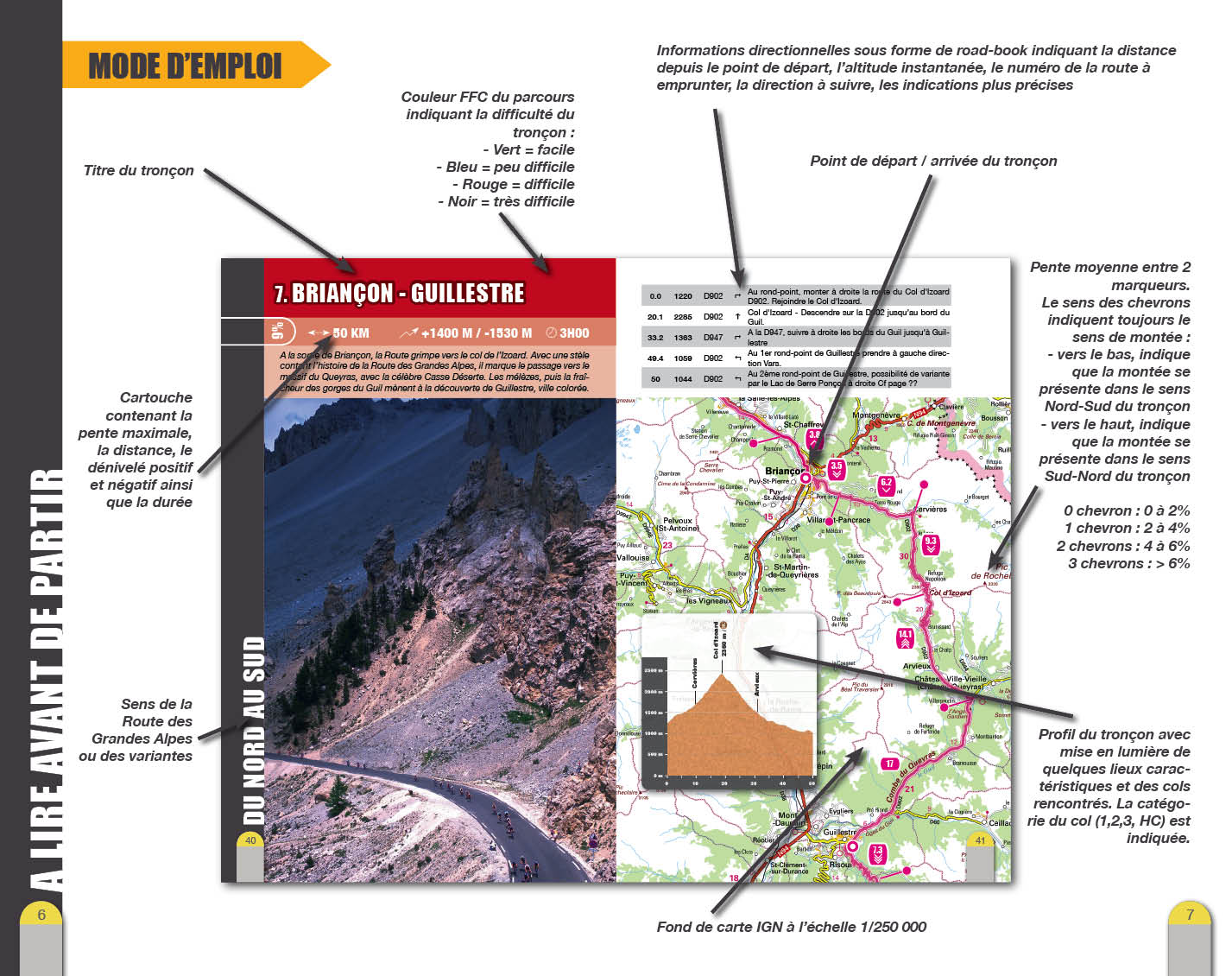
- Traces GPS au format GPX compatibes smartphones et GPS portables
- Des infos récurrentes très utiles : variantes, région, point de vue...
- 116 pages en couleur
- Photos
- Langue(s) : French
- Auteur(s) : Route des Grandes Alpes
- ISBN : 9782916972459
- Date de parution : May 15, 2013
Livraison offerte (sauf MON AFGHANISTAN : un français au cœur des montagnes, livre de plus de 2kg) à partir de 60€ en France métropolitaine, Corse, Andorre et Moncaco. Tous les tarifs ici.
Expédié sous 48h dès parution.
Un lien pour télécharger vos Traces GPS vous sera envoyé par e-mail.
Les Traces GPS sont complémentaires du contenu des topo-guide VTOPO.
Nous vous déconseillons d'utiliser uniquement les Traces GPS sans la consultation du topo-guide en question.
Avec ce dernier, vous aurez accès aux niveaux de difficultés, à des recommandations, des précautions et à un descriptif détaillé, utile en cas d'erreur d'orientation. Vous aurez aussi la possibilité de visualiser des variantes et autres possibilités.

