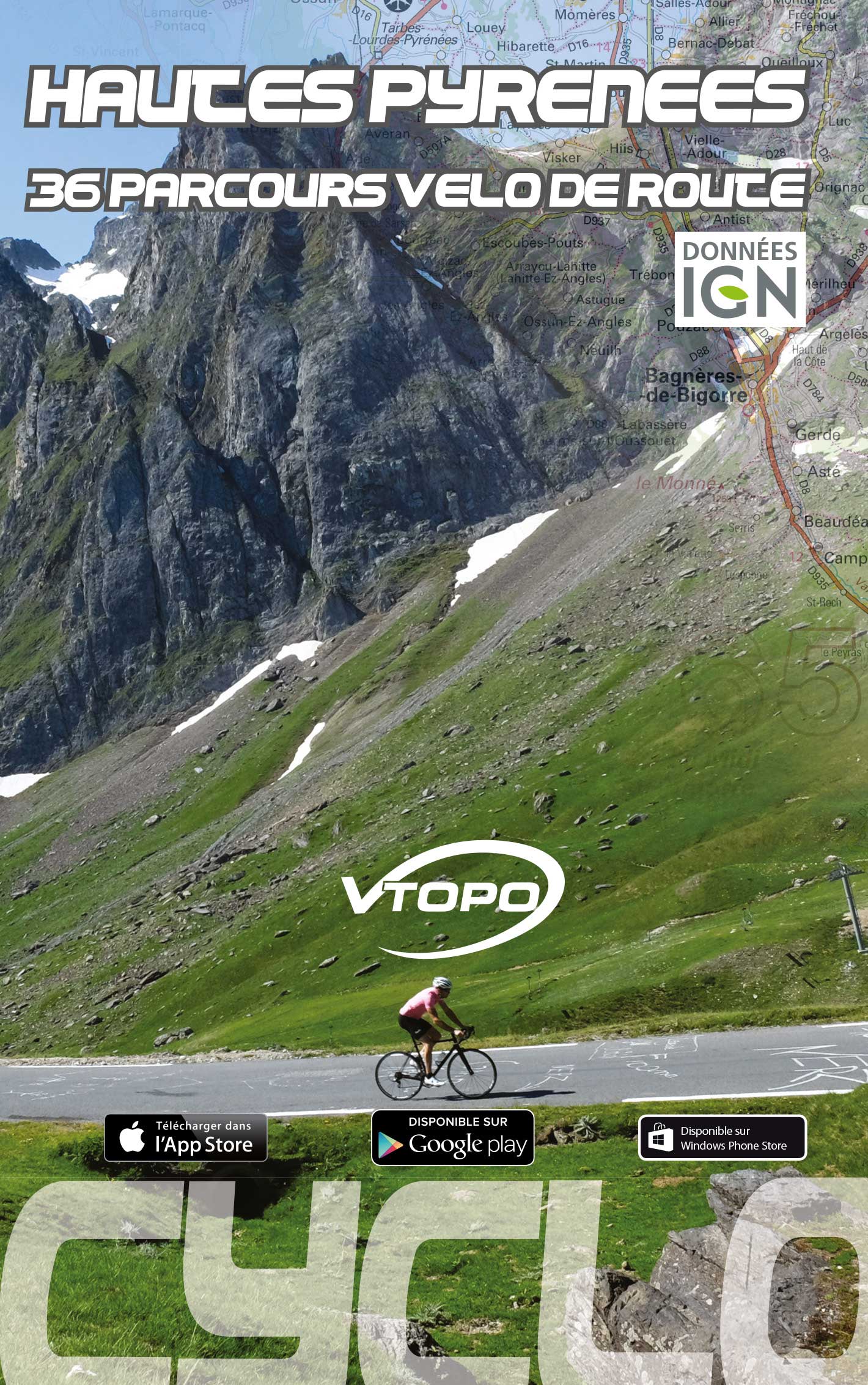


VTOPO Cyclo Hautes Pyrenees
- In stock, ready to ship
By browsing this VTOPO, you will discover 34 road bike routes through the Hautes Pyrénées department: discovery rides, cyclo-sporting outings, climbs, sumptuous landscapes. Whatever your level, beginner, trained or expert, with this VTOPO you will find the course adapted to your desires. Don't wait any longer and discover this fabulous department!
These VTOPO Cyclo are characterized by a targeted approach: each route includes clear and detailed data, IGN maps, useful information, numerous quality photos, a Green, Blue, Red, Black color code indicating the difficulty of the route.